Cycling route guide | caibang village, Qiqu, 18km away from Dianshan Lake
Route name: Dianshan Lake · 18km Qiqu caibang village cycling route overview routeoverview: if you want to find out the best destination for the perfect combination of Dianshan Lake sightseeing and leisure cycling, it is caibang village in Qingpu.
Caibang village is embraced by Dianshan Lake on the East, South and north sides, facing the Oriental Green Boat on the opposite bank across the lake, so it is known as “an island in the lake”.
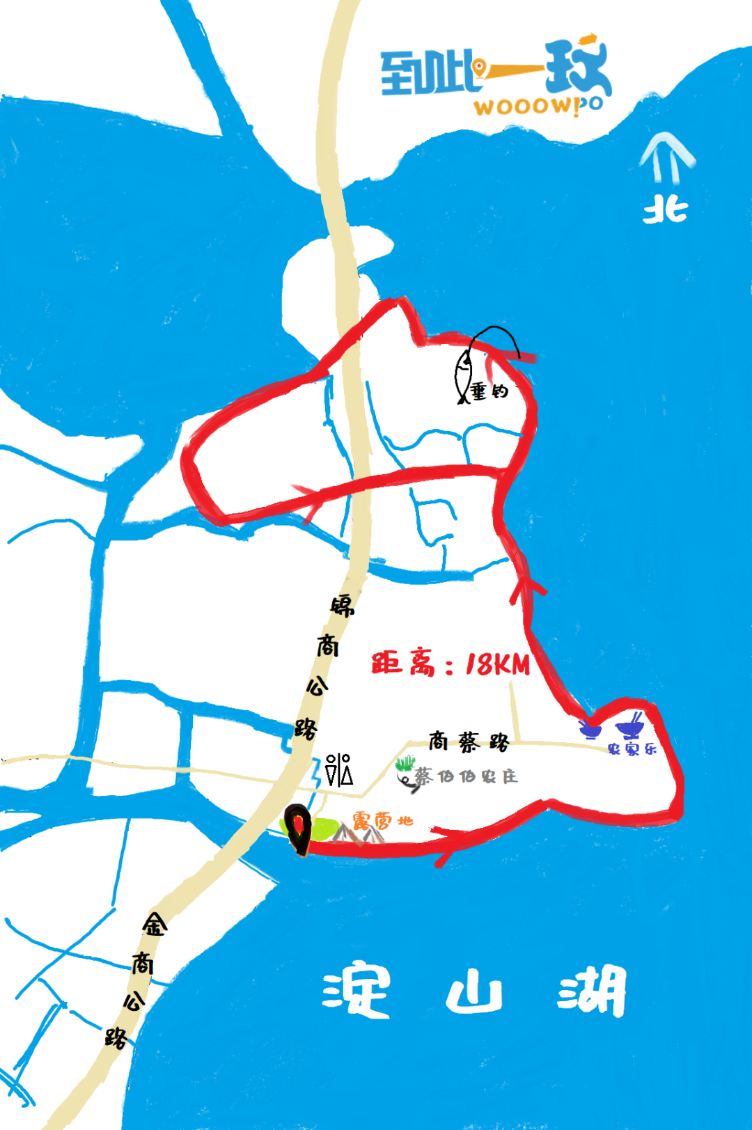
We have developed such an 18 kilometer cycling route.
More than two-thirds of the road is near the lake.
You can ride all the way to enjoy the beautiful scenery of Dianshan Lake from zero distance – willow trees are shaded beside the road, with a wide view and a happy mood! More importantly, caibang village is not only a great place to ride, but also a place to camp by the lake, punch in the ecological farm, and taste farm food.
You can choose one facing Dianshan Lake anywhere near the starting point of the route “Free camp”, you can easily set up your own lake view tent.
In addition to cycling, you can also have a picnic, rest, enjoy the scenery, and go fishing with your family…
If you encounter good weather, the beautiful sunset and gorgeous sunset on the lake in the evening will bring you infinite surprise! This route we designed takes full account of the convenience of self driving car owners.
You can park at the starting point, set up a tent, and there is a bathroom not far away and quite As the famous “caibobo ecological farm”, whether you come with your friends or your family, the starting point is your best gathering point.
Most sections of this route are near the lake, and a small part of it passes through rural fields, enjoying the natural beauty and rural scenery.
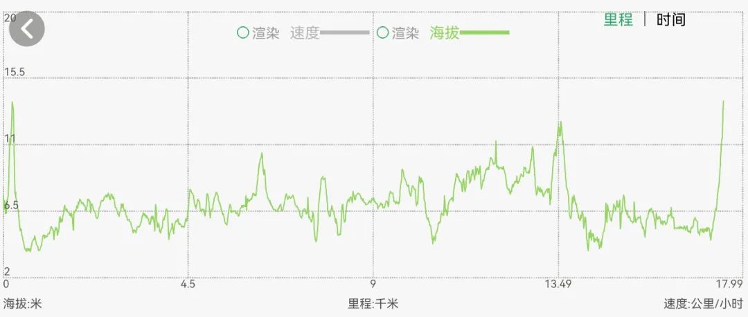
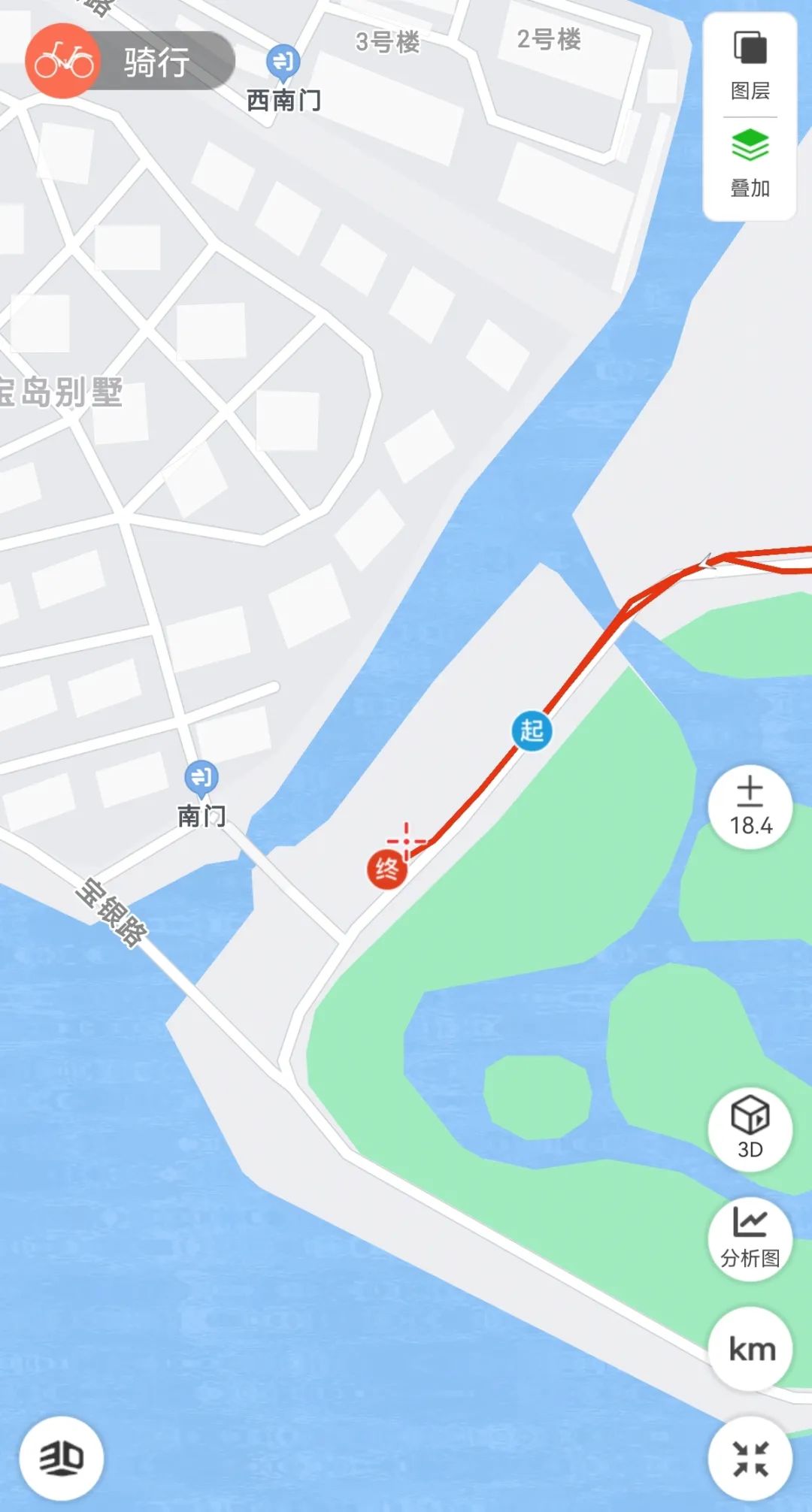
Route planning team designteam:charleslee, jadecao, Dachuangliu route distance: 18km (distance can be increased or decreased as needed) route video routevideo: (video shooting time: 2022.3bydachuangliu) route map Routemap: local map of start and end points start/finish: altitude map hightmap:3d route display (generated by two-step route APP) 3droute: route short video preview (generated by keep) routevideo: Gaode route Code: * method of use: enter Gaode navigation software, Use the “scan” in the software to identify the QR code in the figure below, and use “follow” to ride according to the route.
Don’t worry about getting lost-.

